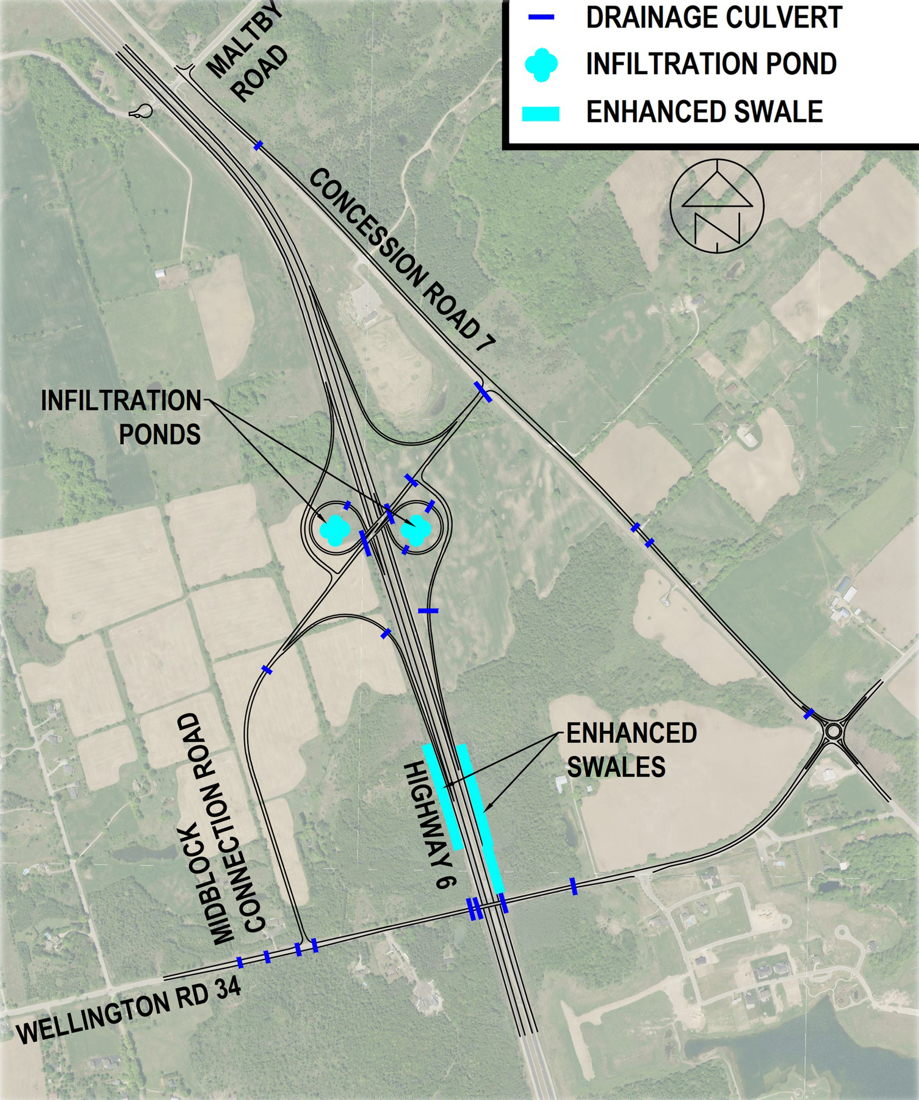
This image is a map illustrating the road network and drainage infrastructure in a specific area near Highway 6. It includes labeled roads, water management features, and traffic control elements.
Roads:
Maltby Road
Concession Road 7
Middleblock Connection Road
Highway 6
Wellington Road 34
Drainage Features:
Drainage Culverts: Marked in blue, located along several road segments.
Infiltration Ponds: Marked in cyan, positioned near intersections and low-lying areas.
Enhanced Swales: Marked in light blue, running parallel to some roads for surface water management.
Traffic Features:
Roundabouts are present at key intersections, including Wellington Rd 34 and Concession Rd 7.
Orientation and Relationships:
The map is oriented with north at the top.
Roads intersect at various points, with drainage features placed strategically for stormwater control.
Labels clearly identify each feature and its location relative to the road network.