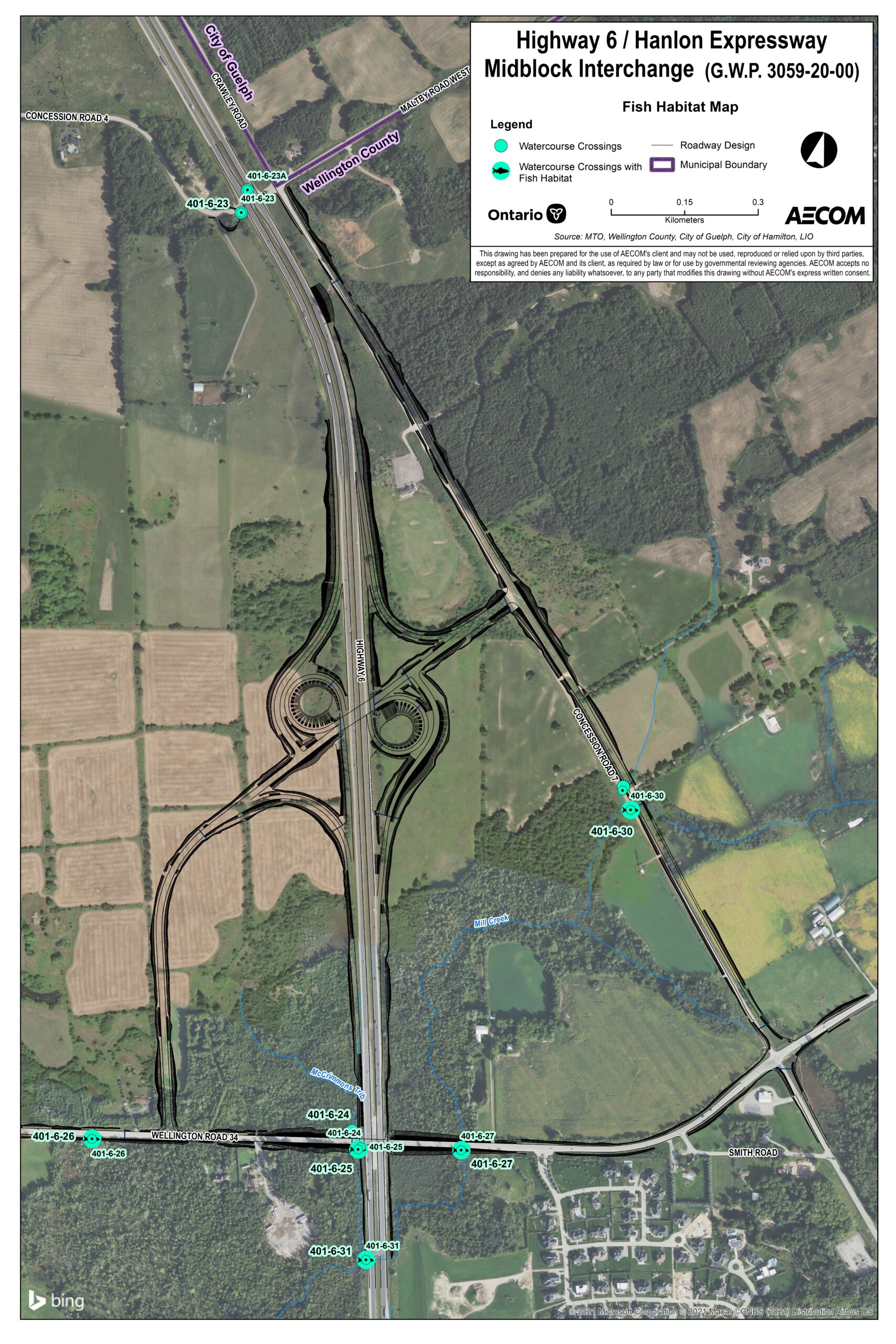
This is a fish habitat map focused on the Highway 6 / Hanlon Expressway Midblock Interchange (G.W.P. 3059-20-00). It displays the surrounding landscape, infrastructure, and ecological features relevant to the project.
Key Map Elements:
Main Highway and Expressway Interchange at the center.
Surrounding Roads:
Wellington County Road 34
Maltby Road
Land Features:
Agricultural fields
Forested areas
Watercourse Features:
Multiple watercourse crossings marked with symbols.
Crossing types indicated by legend.
Legend Includes:
Watercourse Crossing
Watercourse Crossing Type
Roadway Design
Municipal Boundary
Additional Details:
Scale: 0.5 km
Source: MTO – Highway Office of Ontario Ltd.
Logos: Ontario and AECOM
Orientation and Relationships:
Roads and natural features are clearly labeled.
Watercourse crossings are distributed across the map, indicating potential fish habitat zones.
Municipal boundaries help define jurisdictional context for environmental planning.