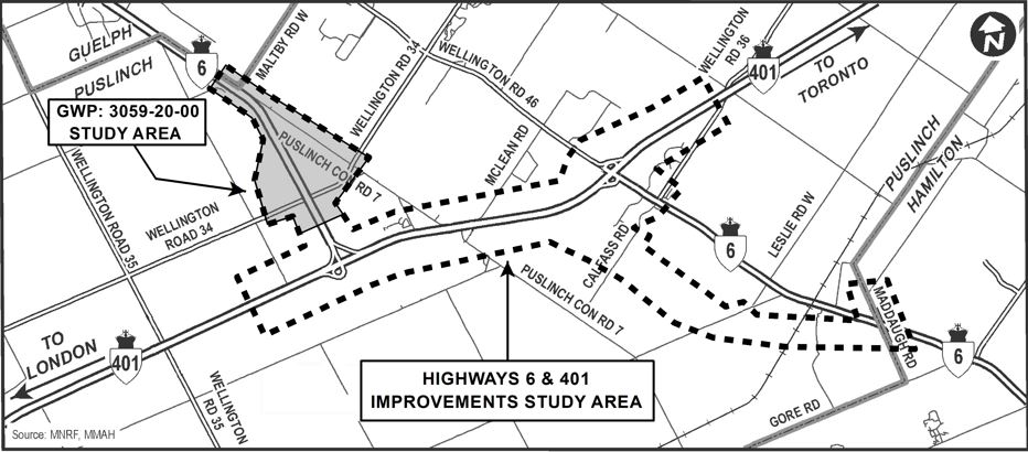
This image is a map titled “Highways 6 & 401 Improvements Study Area.” It outlines a region in southern Ontario where highway infrastructure upgrades are being considered. The study area is enclosed with dashed lines, covering portions of Highway 6, Highway 401, and several connecting roads.
Key geographic features and labels include:
Highway 401 runs horizontally across the map, with directional arrows pointing east toward Toronto and west toward London.
Highway 6 intersects vertically, connecting the cities of Guelph and Puslinch.
Labeled roads within the study area include:
Wellington Road 34
Wellington Road 35
Maltby Road West
McLean Road
Leslie Road West
Gore Road
Maddaugh Road
Nearby cities and towns such as Guelph, Puslinch, and Hamilton are marked for orientation.
The map includes a source attribution to MNRF (Ministry of Natural Resources and Forestry) and MMAH (Ministry of Municipal Affairs and Housing).
This map is intended to inform viewers about the geographic scope of proposed highway improvements, including potential changes to interchanges, road alignments, and traffic flow in the region.

