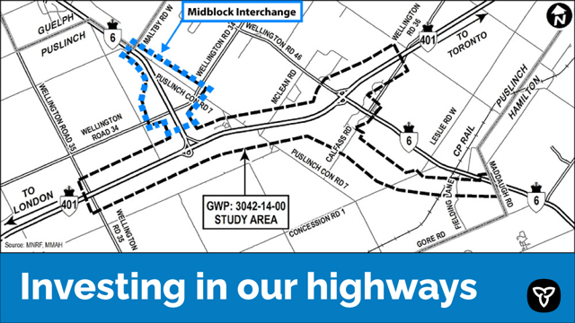
This image is a map illustrating the study area for a proposed Midblock Interchange project in Puslinch, Ontario. The map is oriented with north at the top and focuses on a section of Highway 401, which runs horizontally across the center of the image.
Key elements include:
Highway 401 is prominently displayed, with directional arrows pointing west toward London and east toward Toronto.
The proposed interchange location is situated between Wellington Road 32 and Wellington Road 35, near County Road 46.
A dashed boundary line outlines the study area, labeled “GWP: 3042-14-00 STUDY AREA.”
The surrounding region includes the Puslinch area, with nearby roads and intersections clearly marked.
The map uses a simple color scheme with roads and boundaries clearly delineated for easy interpretation.
At the bottom of the image, a blue banner spans the width of the map, containing the slogan “Investing in our highways” in white text, alongside the Ontario government logo.
This map is intended to inform the public and stakeholders about the geographic scope and location of the proposed infrastructure project.

