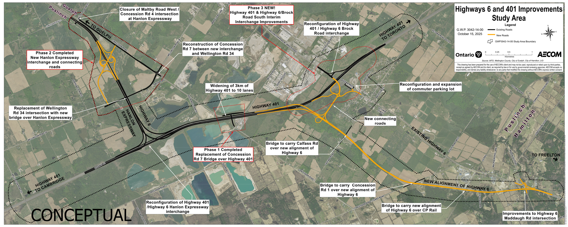
The image is a planning map titled “Highways 6 and 401 Improvements – Investigated Barriers”. It displays a large aerial view of rural and semi-urban areas with major highways highlighted. The map focuses on infrastructure upgrades around Highway 401 and Highway 6 near Guelph, Ontario. Key elements include:
Highlighted Routes and Labels:
– Highway 401 runs horizontally across the center, marked for widening to 10 lanes.
– Hanlon Expressway (Highway 6) intersects Highway 401 from north to south.
– New alignment of Highway 6 shown in orange, bypassing the existing route.
Construction Phases:
– Phase 1: Replacement of Concession Rd 1 bridge over Highway 401.
– Phase 2: New Hanlon Expressway interchange and connecting roads.
– Phase 3: Highway 401 and Highway 6/Brock Road South interchange improvements.
Other Improvements:
– Replacement of Wellington Rd 34 intersection with a new bridge over Hanlon Expressway.
– Reconfiguration of Highway 401/Highway 6 Brock Road interchange.
– Bridges to carry Calfass Rd and Concession Rd 1 over new alignment of Highway 6.
– Bridge to carry new alignment of Highway 6 over CF Rail.
Expansion of commuter parking lot.
– Improvements to Highway 6/Maddaugh Rd intersection.
Visual Details:
– Roads and alignments are color-coded (orange for new alignments, black for existing highways).
– Agricultural fields and water bodies are visible in the background.
– Labels in white boxes with red or black text indicate specific project components.