
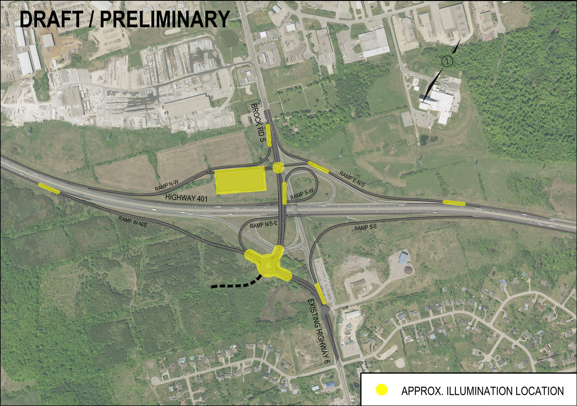
A colour aerial image labeled “Draft / Preliminary” showing the existing Highway 401 and Brock Road interchange overlayed with the proposed Highway 401 Brock Road interchange design. Highway 401 runs horizontally across the center, intersected by the north–south Brock Road South and Highway 6. Various ramps and a roundabout are visible as part of the proposed interchange layout. Several elements are highlighted in yellow to indicate approximate illumination locations, including along ramps, at intersections, and around the roundabout. A legend in the bottom right corner identifies the yellow symbols as “Approximate Illumination Location.” Surrounding land uses include wooded areas, fields, commercial or industrial buildings to the north, and natural areas and residential neighbourhoods to the south.