
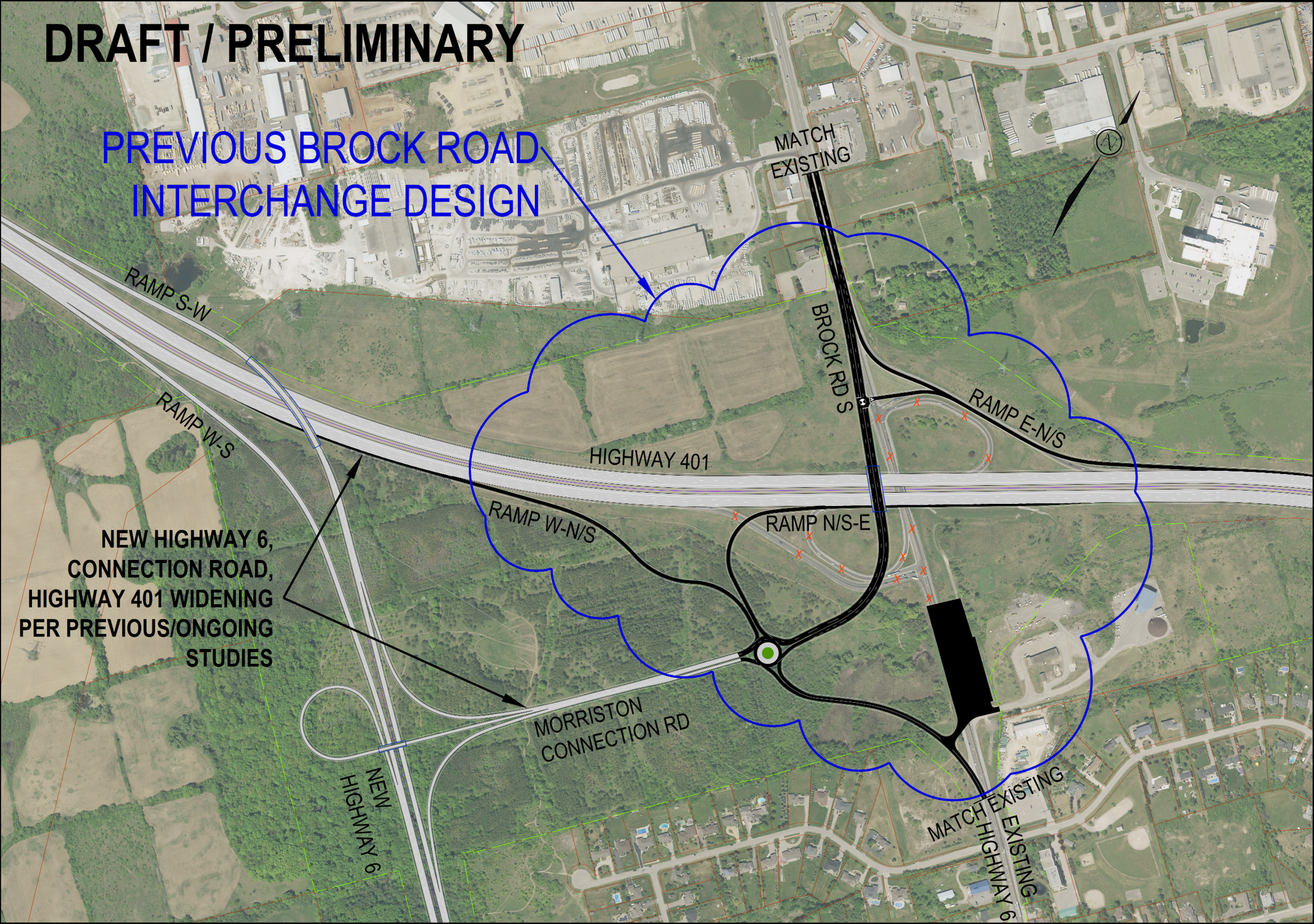
A colour aerial image overlaid with a draft of the previous Brock Road interchange design at Highway 401. Highway 401 runs horizontally across the image, with Brock Road crossing north–south. Proposed changes are highlighted with dark lines and labels showing ramp configurations, including ramps connecting northbound, southbound, eastbound, and westbound traffic. A roundabout is shown south of the highway where new ramps converge with Brock Road South and Highway 6. Blue outlined areas indicate the design study boundary, and annotations label features such as “Ramp north and south to east,” “Ramp West to north and south,” and “Ramp east to north and south.” Additional notes indicate future Highway 6 connections and Morrison Connection Road. Surrounding land uses include agricultural fields, wooded areas, and nearby residential developments. Image has a “Draft / Preliminary” label at the top.